Unlocking Precision: The Significance of Planimetric Mapping Services
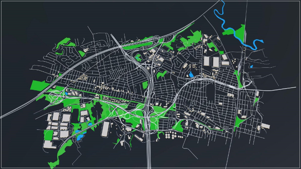
In the realm of modern cartography and geographic information systems (GIS), planimetric mapping services stand as a cornerstone for accurate representation and analysis of spatial data. These services offer a detailed view of the Earth's surface, delineating features, structures, and boundaries without considering variations in elevation. From urban planning to environmental management, planimetric mapping plays a vital role in various fields, enabling precise decision-making and informed strategies.
Understanding Planimetric Mapping
Defining Planimetry
At its core, planimetry deals with the measurement of the two-dimensional aspects of objects or spaces, disregarding their elevation or vertical components. In cartography, planimetric maps portray features such as roads, buildings, water bodies, vegetation, and other physical entities on a flat surface, providing a comprehensive overview of a particular area.
Elements of Planimetric Mapping
Planimetric mapping involves the representation of both natural and man-made features. These elements include:
Transportation Networks:
Roads, highways, railways, airports, and other transit infrastructure are accurately depicted to facilitate transportation planning, logistics, and emergency services.
Land Use and Land Cover:
Planimetric maps delineate various land uses such as residential, commercial, industrial, agricultural areas, as well as forests, parks, and open spaces.
Buildings and Structures:
Every structure, from residential homes to commercial complexes, bridges, and landmarks, is meticulously outlined to aid urban development, architectural planning, and emergency response operations.
Water Bodies:
Rivers, lakes, ponds, reservoirs, and coastlines are depicted with precision to support hydrological studies, environmental conservation efforts, and water resource management.
Vegetation and Green Spaces:
Planimetric mapping identifies vegetation types, forests, parks, and gardens, enabling ecologists, urban planners, and conservationists to monitor biodiversity and plan sustainable landscapes.
Technologies Driving Planimetric Mapping
The advent of advanced technologies has revolutionised the process of planimetric mapping, enhancing accuracy, efficiency, and scalability. Some key technologies include:
Remote Sensing:
Satellite imagery, aerial photography, LiDAR (Light Detection and Ranging), and drones capture high-resolution data, allowing cartographers to create detailed maps with precise feature identification.
GIS Software:
Geographic Information Systems (GIS) software such as ArcGIS, QGIS, and MapInfo provide robust tools for data processing, analysis, and visualisation, enabling cartographers to create, edit, and manipulate planimetric maps with ease.
Global Positioning System (GPS):
GPS technology facilitates accurate geolocation and mapping by providing real-time positioning data, allowing field surveyors and researchers to collect spatial information with high precision.
3D Modelling:
While planimetric mapping primarily focuses on two-dimensional representations, advancements in 3D modelling technologies enable the integration of elevation data, enhancing the visualisation and analysis of spatial relationships.
Applications of Planimetric Mapping Services
Urban Planning and Development
In urban environments, planimetric mapping services play a pivotal role in urban planning, infrastructure development, and land management. City planners utilize planimetric maps to analyse existing land use patterns, identify suitable locations for new developments, assess infrastructure requirements, and mitigate environmental impacts.
Emergency Management and Response
During emergencies such as natural disasters, accidents, or public health crises, planimetric mapping services are indispensable for emergency management and response teams. Accurate maps help responders navigate affected areas, identify evacuation routes, locate critical facilities such as hospitals and shelters, and assess damage to infrastructure.
Environmental Conservation and Management
Planimetric mapping supports environmental conservation efforts by providing valuable insights into ecosystems, habitat distribution, and land cover changes. Conservationists use these maps to monitor deforestation, track wildlife habitats, plan protected areas, and implement sustainable land management practices.
Infrastructure and Utilities Management
Government agencies and utility companies rely on planimetric mapping services to manage essential infrastructure such as water supply networks, electrical grids, telecommunications systems, and transportation corridors. Detailed maps aid in infrastructure maintenance, asset management, and spatial analysis to ensure efficient service delivery.
Real Estate and Property Management
In the real estate sector, planimetric mapping services facilitate property valuation, site selection, land development, and zoning compliance. Real estate agents, developers, and investors leverage accurate maps to assess property boundaries, analyze market trends, and make informed investment decisions.
Transportation Planning and Logistics
Planimetric mapping supports transportation planning initiatives by providing critical information on road networks, traffic patterns, public transit routes, and logistics infrastructure. Transportation planners utilize these maps to optimize route planning, improve traffic flow, and enhance the overall efficiency of transportation systems.
Challenges and Future Trends
While planimetric mapping services offer numerous benefits, they also face certain challenges and evolving trends:
Data Accuracy and Currency:
Maintaining the accuracy and currency of spatial data remains a significant challenge, especially in rapidly changing urban environments and remote regions with limited accessibility.Integration of 3D and Dynamic Data: As the demand for three-dimensional mapping and dynamic spatial data grows, integrating 3D modelling techniques and real-time data streams into planimetric mapping workflows presents both technical and logistical challenges.
Privacy and Data Security:
With the increasing availability of location-based services and spatial data platforms, ensuring the privacy and security of sensitive geospatial information emerge as critical concerns for both individuals and organisations.
Artificial Intelligence and Automation:
The adoption of artificial intelligence (AI) and machine learning algorithms holds promise for automating various aspects of planimetric mapping, from feature extraction and classification to data validation and quality assurance.
Collaborative Mapping Initiatives:
Collaborative mapping initiatives and open data platforms empower communities, researchers, and policymakers to contribute to the creation and maintenance of spatial data repositories, fostering transparency, innovation, and data-driven decision-making.
Conclusion
In conclusion, planimetric mapping services serve as indispensable tools for visualising, analysing, and interpreting spatial data across diverse domains. From urban planning and emergency management to environmental conservation and infrastructure development, the applications of planimetric maps are vast and varied. By embracing technological advancements, addressing key challenges, and promoting collaboration, the field of planimetric mapping continues to evolve, enabling us to navigate and understand our ever-changing world with greater precision and insight.
